skip to main | skip to sidebar

Map Catalog

Friday, August 8, 2008

Planimetric Map

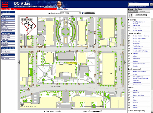
A planimetric map portrays the features of an area with respect to horizontal relation. It does not take into account any vertical features of the area. This planimetric map shows the downtown area of Washington, DC.
Posted by katehocker at 4:46 PM

No comments:

Post a Comment

Newer Post Older Post Home
Subscribe to: Post Comments (Atom)

Blog Archive

  • ▼  2008 (32)
    • ▼  August (31)
      • DEM Map
      • Continuously Variable Proportional Circle Map
      • This is a range graded proportional circle map. E...
      • DOQQ
      • Lorenz Curve
      • Cartographic Animation
      • DRG
      • Isotach Map
      • Isobars
      • Flow Map
      • Stem and Leaf Plot
      • LIDAR Image
      • Correlation Matrix
      • Star Plot
      • Planimetric Map
      • Cadastral Map
      • Thematic Map
      • Topographic Map
      • Population Profile
      • Climograph
      • Propaganda Map
      • Dot Distribution Map
      • Doppler Radar Image
      • Infrared Aerial Photo
      • Box Plot
      • Statistical Map
      • Cartogram
      • Scatterplot
      • Windrose
      • Mental Map
      • Black and White Aerial Photo
    • ►  June (1)

About Me

katehocker
View my complete profile